


01301 - 01 Voting District, Barrow County, Georgia
About
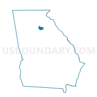
Outline

Summary
| Unique Area Identifier | 560289 |
| Name | 01301 - 01 Voting District |
| County | Barrow County |
| State | Georgia |
| Area (square miles) | 17.24 |
| Land Area (square miles) | 16.79 |
| Water Area (square miles) | 0.45 |
| % of Land Area | 97.38 |
| % of Water Area | 2.62 |
| Latitude of the Internal Point | 33.92865260 |
| Longtitude of the Internal Point | -83.69021990 |
Maps


Graphs
Select a template below for downloading or customizing gragh for 01301 - 01 Voting District, Barrow County, Georgia


Neighbors
Neighoring Voting District (by Name) Neighboring Voting District on the Map
- 01305 - 05 Voting District, Barrow County, GA
- 01316 - 16 Voting District, Barrow County, GA
- 21908 - DARK CORNER Voting District, Oconee County, GA
- 297250 - CAMPTON Voting District, Walton County, GA
- 297414 - GRATIS Voting District, Walton County, GA
Top 10 Neighboring County Subdivision (by Population) Neighboring County Subdivision on the Map
- Winder CCD, Barrow County, GA (24,572)
- Bethlehem CCD, Barrow County, GA (15,017)
- Statham CCD, Barrow County, GA (11,184)
- Bogart CCD, Oconee County, GA (10,590)
- Campton CCD, Walton County, GA (8,454)
Top 10 Neighboring Place (by Population) Neighboring Place on the Map
Top 10 Neighboring Unified School District (by Population) Neighboring Unified School District on the Map
- Walton County School District, GA (79,547)
- Barrow County School District, GA (69,367)
- Oconee County School District, GA (32,808)
Top 10 Neighboring State Legislative District Lower Chamber (by Population) Neighboring State Legislative District Lower Chamber on the Map
- State House District 108, GA (68,282)
- State House District 111, GA (62,275)
- State House District 113, GA (56,617)
Top 10 Neighboring State Legislative District Upper Chamber (by Population) Neighboring State Legislative District Upper Chamber on the Map
Top 10 Neighboring 111th Congressional District (by Population) Neighboring 111th Congressional District on the Map
Top 10 Neighboring Census Tract (by Population) Neighboring Census Tract on the Map
- Census Tract 301, Oconee County, GA (10,590)
- Census Tract 1101, Walton County, GA (8,454)
- Census Tract 1805.03, Barrow County, GA (5,404)
- Census Tract 1804.01, Barrow County, GA (5,191)
- Census Tract 1805.02, Barrow County, GA (4,534)
- Census Tract 1803.01, Barrow County, GA (2,062)